Drone Surveying and Mapping: How Drones Are Changing Land Surveying in India
Drone technology is transforming many industries, and land surveying and mapping are among the areas where drones are creating significant opportunities.
Traditional land surveying can require considerable time, planning, equipment, and manual work. Survey professionals often need to collect information from large areas of land, construction sites, infrastructure projects, and other locations.
Drones provide a new way to collect aerial images and information from above.
With the right equipment, software, skilled professionals, and proper planning, drone technology can support surveying and mapping projects more efficiently.
Today, drones are being used in construction, land development, agriculture, infrastructure, mining, real estate, and many other industries.
This article explains how drone surveying and mapping work, their applications, benefits, and the future of aerial technology in India.
What Is Drone Surveying?
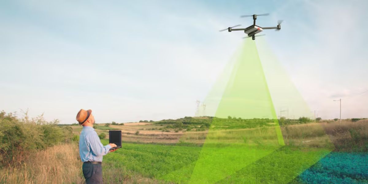
Drone surveying involves using drones to collect aerial images and information about a specific area.
A drone can fly over land or a project site and capture images from different positions.
The collected information can then be processed using suitable software and professional tools.
Drone surveying can support professionals who need aerial information about large areas.
Depending on the project and equipment being used, drone technology can become part of a larger surveying workflow.
Professional surveying projects require proper planning and skilled professionals who understand both drone technology and surveying requirements.
What Is Drone Mapping?
Drone mapping involves using aerial information collected by drones to create maps and visual representations of an area.
Drones can capture multiple images while flying over a planned location.
These images can be processed using specialized technology to create useful visual information.
Drone mapping can be used for land observation, construction planning, infrastructure projects, agricultural fields, and other professional applications.
The type of map and information required depends on the purpose of the project.
Different projects may require different drones, cameras, sensors, software, and professional expertise.
Why Are Drones Useful for Surveying?
One of the biggest advantages of drones is their ability to provide an aerial view.
A large area can be observed from above without requiring professionals to manually travel across every part of the location.
This can be useful for projects involving large properties, construction sites, agricultural land, and difficult-to-access areas.
Drones can help professionals collect visual information efficiently.
However, drone technology is a tool that supports professional work. The quality and usefulness of the final results depend on the equipment, planning, data processing, and expertise involved in the project.
Applications of Drone Surveying
Drone surveying can be used in many industries.
Some common applications include:
Land Surveying
Construction Site Monitoring
Land Development
Agricultural Land Observation
Infrastructure Projects
Mining Operations
Real Estate
Road Projects
Industrial Sites
Environmental Observation
Large Property Mapping
Different industries use drone technology according to their specific requirements.
Land Surveying with Drones
Land surveying is one of the major professional applications of drone technology.
Surveyors often need to understand the size, shape, and visible features of an area.
Aerial technology can provide a wider perspective compared with ground-level observation.
Drones can support land surveying projects by collecting aerial images and information.
For large areas, aerial observation can help professionals understand the overall layout of the location.
The information collected may then be used as part of professional surveying and planning processes.
Drones in Construction Projects
Construction companies are increasingly using drones for project monitoring and site observation.
Large construction projects can change quickly as work progresses.
A drone can capture aerial views of the site at different stages of development.
These images can help project teams observe visible progress and maintain visual records.
Drone technology can support:
Construction site observation
Project progress monitoring
Aerial documentation
Land observation
Site planning
Visual reporting
Regular aerial images can help businesses maintain a record of project development over time.
Drone Mapping for Infrastructure Projects
Infrastructure projects often involve large areas and complex locations.
Roads, bridges, buildings, industrial facilities, and other infrastructure may require detailed planning and observation.
Drones can provide aerial visuals that support professionals working on these projects.
The ability to observe a large area from above can be useful during planning and project management.
Professional teams can use drone technology as part of their overall workflow.
Drones in Agriculture Mapping
Agriculture is another important area for drone mapping.
Large farms can be difficult to observe manually.
Drones can provide aerial views of agricultural land and help farmers or agricultural professionals understand the visible condition and layout of their fields.
Drone technology can support:
Field observation
Crop monitoring
Agricultural planning
Land mapping
Farm management
Smart farming activities
Different agricultural projects may require different technologies and professional knowledge.
Drones for Mining Projects
Mining projects often involve large areas that can be difficult to observe from the ground.
Aerial technology can provide useful views of mining locations.
Drones can help professionals capture images and observe visible changes across a project site.
Drone technology may support planning, monitoring, and documentation activities.
Mining operations require professional planning and appropriate safety procedures.
Real Estate and Land Development
Drone technology is also useful for real estate and land development projects.
Aerial views can help businesses show the complete size and surroundings of a property.
Developers can use drone images and videos for planning, documentation, and marketing.
Potential buyers can also gain a better understanding of the location through aerial visuals.
For large land development projects, drone technology can provide useful visual information about the area.
Benefits of Drone Surveying and Mapping
Drone technology offers several potential benefits for professional projects.
One important benefit is the ability to observe large areas from above.
Other benefits can include:
Aerial perspective
Faster visual data collection
Access to difficult locations
Improved project documentation
Regular site monitoring
Better visual communication
Support for planning activities
Efficient observation of large areas
The actual benefits depend on the specific project, equipment, and professional workflow.
Drone Surveying Can Save Time
Traditional methods of collecting information across a large area can require significant time.
Drones can help professionals capture aerial visuals more efficiently in suitable situations.
A planned drone flight can collect information across a project area.
This information can then be reviewed and processed as required.
Time savings can be especially useful for large construction projects, agricultural fields, land development projects, and infrastructure locations.
Accessing Difficult Areas
Some locations can be difficult or unsafe to access directly.
Drones can provide aerial visuals without requiring people to physically reach every location.
This can be useful for observing tall structures, difficult terrain, large construction sites, and remote areas.
Professional operators should always plan flights carefully and follow appropriate safety practices.
The ability to observe difficult locations from above is one of the major advantages of drone technology.
The Importance of Proper Planning
Professional drone surveying projects require careful planning.
Before beginning a project, professionals should understand the location and the purpose of the operation.
Planning may include:
Understanding the project area
Preparing equipment
Checking weather conditions
Planning flight operations
Checking batteries
Preparing cameras and sensors
Identifying possible obstacles
Planning data collection
Good planning can help improve the efficiency and safety of drone operations.
Choosing the Right Drone
Not every drone is suitable for surveying and mapping projects.
The right equipment depends on the requirements of the project.
Important factors may include:
Camera quality
Sensor technology
Flight time
Battery requirements
GPS capabilities
Payload capacity
Operating environment
Software compatibility
Technical support
Businesses should understand their project requirements before investing in drone technology.
The Importance of Skilled Professionals
Drone surveying and mapping require more than simply flying a drone.
Professional projects may require knowledge of surveying, mapping, aerial data collection, technology, and software.
A skilled professional understands how to plan operations and collect useful information.
Experience can also help improve the quality and reliability of professional drone projects.
Businesses should work with qualified professionals for specialized operations.
Drone Data and Software
The drone itself is only one part of a professional mapping workflow.
The information collected by a drone may need to be processed using appropriate software and technology.
Different software solutions can help professionals organize and analyze aerial images and project information.
The type of software required depends on the purpose of the project.
Technology continues to improve, creating new possibilities for aerial data collection and analysis.
Drone Safety During Surveying Operations
Safety should always be an important part of professional drone operations.
Before every flight, operators should inspect the equipment and understand the operating environment.
Important safety checks can include:
Drone condition
Battery level
Propeller inspection
Weather conditions
GPS status
Nearby obstacles
Project location
Communication systems
Emergency procedures
A professional approach to safety can help reduce unnecessary risks.
Challenges in Drone Surveying
Although drone technology offers many opportunities, there are also practical challenges.
Weather conditions can affect drone operations.
Strong winds, rain, and poor visibility can make flights difficult.
Battery limitations can also affect how long a drone can remain in the air.
Large projects may require careful battery planning.
Technical problems, equipment maintenance, and data processing requirements must also be considered.
Understanding these challenges is important before starting a professional drone project.
The Future of Drone Surveying in India
The future of drone surveying and mapping in India is full of possibilities.
As technology improves, drones are becoming more advanced.
New cameras, sensors, artificial intelligence, automation, and software systems may improve the way professionals collect and analyze aerial information.
Future drone systems may become more intelligent and specialized.
Businesses and professionals may discover new applications across construction, infrastructure, agriculture, mining, land development, and many other industries.
Drone technology is likely to continue becoming an important part of modern surveying and mapping workflows.
How Businesses Can Benefit from Drone Technology
Businesses can use drone technology to support better planning and project observation.
Aerial visuals can help teams communicate more effectively.
Regular drone operations can also help maintain visual records of project progress.
Before investing in drones, businesses should understand their specific requirements.
The right technology, skilled operators, proper planning, and professional processes are important for successful drone operations.
Conclusion
Drone surveying and mapping are changing the way professionals observe and understand large areas.
From land surveying and construction to agriculture, infrastructure, mining, and real estate, drones are creating new opportunities across many industries.
The aerial perspective provided by drone technology can support faster observation, improved project documentation, and better planning.
However, successful drone surveying requires the right equipment, skilled professionals, proper planning, data processing, and responsible operations.
As technology continues to develop, drones will likely play an even bigger role in the future of surveying and mapping in India.
GarudHub supports the growing drone ecosystem by connecting businesses, professionals, drone services, technology, training, and opportunities across the drone industry.